-
 Anglický jazyk
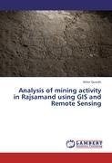
Analysis of mining activity in Rajsamand using GIS and Remote Sensing
Autor: Ather Qureshi
Nearly 25 yrs ago, large-scale mining began in the Rajsamand area. Mining and smelting at its base metal deposits in this region are one of the oldest in the world, dating back to more than 2500 yrs. Mining industry in the region is today deriving and garnering... Viac o knihe
Na objednávku
45.36 €
bežná cena: 50.40 €
O knihe
Nearly 25 yrs ago, large-scale mining began in the Rajsamand area. Mining and smelting at its base metal deposits in this region are one of the oldest in the world, dating back to more than 2500 yrs. Mining industry in the region is today deriving and garnering its profitability purely through sustainable exploitation of scarce natural resources. Thus, monitoring of mining activity in this area over years become important. Remote sensing satellite data provide wide area coverage for such events. The present study addresses monitoring of mining activity and its impact on the natural resources using GIS data packages. The study become significant, as the assessment of erratic mining activities would prove helpful in minimizing the hazard it is causing to the ecology and other natural resources by checking them and employing suitable measures to combat the havoc caused by them.
- Vydavateľstvo: LAP LAMBERT Academic Publishing
- Rok vydania: 2012
- Formát: Paperback
- Rozmer: 220 x 150 mm
- Jazyk: Anglický jazyk
- ISBN: 9783659315060




 Nemecký jazyk

