-
 Anglický jazyk
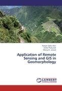
Application of Remote Sensing and GIS in Geomorphology
Autor: Gitika Thakuriah
Remote sensing and Geomorphology are two disciplines of science, where geomorphology is the science of study of landforms of the earth. It is concerned with pattern of landform, materials and their related processes. Geomorphology as a science deals with... Viac o knihe
Na objednávku
54.63 €
bežná cena: 60.70 €
O knihe
Remote sensing and Geomorphology are two disciplines of science, where geomorphology is the science of study of landforms of the earth. It is concerned with pattern of landform, materials and their related processes. Geomorphology as a science deals with evolutionary processes of relief forms of the earth and lead us to understand various processes of evolution of landforms.Remote sensing is the science of acquiring information about an object or phenomena close to the earth's surface by measuring electromagnetic radiation. Remote sensing is an effective tool that enables understanding of aerial and satellite images containing integrated information's of the features on the ground such as landform, ecology, available resources and impact of human interference on the natural landscape. The present collection of articles is the result of research study undertaken in different field areas of Assam. Land use and land cover change (LULC) is one of the focal themes in geomorphic study. It has great significance in analysis of changing nature of land use practices, causes of increasing intensity of resource use and changing relationship between Man's activities with nature.
- Vydavateľstvo: LAP LAMBERT Academic Publishing
- Rok vydania: 2012
- Formát: Paperback
- Rozmer: 220 x 150 mm
- Jazyk: Anglický jazyk
- ISBN: 9783844353631


 Nemecký jazyk

