-
 Anglický jazyk
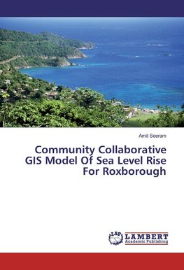
Community Collaborative GIS Model Of Sea Level Rise For Roxborough
Autor: Amit Seeram
Small island developing states are susceptible to the impacts of climate change, in particular rising sea level. Knowing where may be inundated by rising sea level allows policy makers to have a lead if mitigation and/or adaptation strategies were to be... Viac o knihe
Na objednávku
60.12 €
bežná cena: 66.80 €
O knihe
Small island developing states are susceptible to the impacts of climate change, in particular rising sea level. Knowing where may be inundated by rising sea level allows policy makers to have a lead if mitigation and/or adaptation strategies were to be formulated in small island developing states. In this study within Roxborough, Tobago, the methodology utilized topographical features, soils, land use/cover and local knowledge inputs in the development of eographic information systems models. Datasets used were acquired using secondary sources of data, while local knowledge was a product of participatory 3D modelling. Maps were produced that communicate the potential inundation impacts using: isostatic, eustatic and calculated sea level rise scenarios spatially overlaid onto topographical features, land use/cover, soils and local knowledge data. Analyses were conducted which generated the number of buildings, length of roads, area of land, land use/cover types, soil groups and local knowledge projected to be affected by inundation. The model has been validated using land surveying techniques, and sensitivity analysis performed on the GIS model giving this project some credibility.
- Vydavateľstvo: LAP LAMBERT Academic Publishing
- Rok vydania: 2016
- Formát: Paperback
- Rozmer: 220 x 150 mm
- Jazyk: Anglický jazyk
- ISBN: 9783659939167


 Nemecký jazyk


