-
 Anglický jazyk
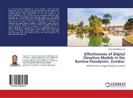
Effectiveness of Digital Elevation Models in the Barotse Floodplain, Zambia:
Autor: Elias Awol Mohammed
The extensive Barotse floodplain in western Zambia is among the most flood prone area. This study focused on hydrodynamic flood modeling to simulate flood inundation characteristics that will benefit provision of recession farming, canal management, and... Viac o knihe
Na objednávku
33.30 €
bežná cena: 37.00 €
O knihe
The extensive Barotse floodplain in western Zambia is among the most flood prone area. This study focused on hydrodynamic flood modeling to simulate flood inundation characteristics that will benefit provision of recession farming, canal management, and land use planning in the Barotse floodplain. For this study the one-dimensional hydrodynamic model (HEC-RAS 4.1.), HEC-GeoRAS10 (GIS extension), ARC-GIS 10, and Google Earth are used. The SRTM 30-m, SRTM 90-m, and ASTER 30-m DEMs are first compared to select a better DEM for model simulation. This was done by a visual comparison and through objective functions using SRTM 30-m as reference. The mean elevation deviation of SRTM 90-m ranges from 0 to 1m and STER 30-m ranges from -9 to 3m. SRTM 30-m better captured the channel geometry and the heterogeneity of the floodplain to a certain details. ASTER 30-m as resulted in a somewhat exaggerated elevation of river channel banks. The floodplain terrain slope shows the largest variation in ASTER 30-m and the least variation for the course DEM SRTM 90-m. This study was a first attempt to model the flood dynamics of the complex Brotse floodplain.
- Vydavateľstvo: LAP LAMBERT Academic Publishing
- Rok vydania: 2018
- Formát: Paperback
- Rozmer: 220 x 150 mm
- Jazyk: Anglický jazyk
- ISBN: 9786202060325
 Nemecký jazyk
