-
 Anglický jazyk
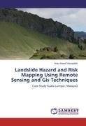
Landslide Hazard and Risk Mapping Using Remote Sensing and Gis Techniques
Autor: Anas Nawaf Alaraqdeh
Landslides represent one of the most common geo-hazards that affect the steep lands, and may destroy crop lands as well as urban and industrial development. Landslide risk analysis can help government agencies to select suitable locations for development... Viac o knihe
Na objednávku
45.36 €
bežná cena: 50.40 €
O knihe
Landslides represent one of the most common geo-hazards that affect the steep lands, and may destroy crop lands as well as urban and industrial development. Landslide risk analysis can help government agencies to select suitable locations for development schemes and plan mitigation measures in unstable landslide-prone areas, as well provide conservation areas to protect county development. The study describes an approach for assessing the landslide risk potentials, as well present method of calculating the Landslide factors influence distribution map, which comes helpful in engineering conservation plans to protect investment in a particular area. In this study, two factors (rainfall and slope) were taken as subject of landslide geo-hazard. The study shows that remote sensing techniques when integrate with GIS can provide a useful tool to study potential landslide area. The result shows a landslides map, that presents different level of risk in five categories of classification. The very high risk area covers approximately 0.21% of the total area. In addition, influences of each rainfall and the slope show that rainfall has much influence than slope effect, on very high level of ha
- Vydavateľstvo: LAP LAMBERT Academic Publishing
- Rok vydania: 2011
- Formát: Paperback
- Rozmer: 220 x 150 mm
- Jazyk: Anglický jazyk
- ISBN: 9783845472355



 Nemecký jazyk

