-
 Anglický jazyk
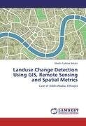
Landuse Change Detection Using GIS, Remote Sensing and Spatial Metrics
Autor: Mesfin Tadesse Bekalo
The rapid development of urbanization coupled with fast demographic change and high demand for land resource requires landuse information for management and planning of urban regions. The advent of geospatial tools has great potential to long term monitoring... Viac o knihe
Na objednávku
45.36 €
bežná cena: 50.40 €
O knihe
The rapid development of urbanization coupled with fast demographic change and high demand for land resource requires landuse information for management and planning of urban regions. The advent of geospatial tools has great potential to long term monitoring and assessment of urban growth and its associated problems in surrounding landcover. This study analyzes landuse change of Addis Ababa, Ethiopia, using GIS, Spatial Metrics and remotely sensed data of landsat TM and ETM acquired, respectively, in 1986 and 2000. The landcover maps with four classes were generated using the Maximum Likelihood Algorithm of Supervised Classification. Overall classification accuracy was tested by Confusion Metrics and Kappa Coefficient. The landcover dynamics in pattern and quantities were analyzed using selected Spatial Metrics units. It has been found that tremendous changes in landcover occurred over the study period. The results indicated that the built-up area expanded by 49% with annual growth rate around 3.5% with significant fragmentation and contagion of small isolated urban patches. Managers and planners could use this data as a decision-support tool for urban and environment management.
- Vydavateľstvo: LAP LAMBERT Academic Publishing
- Rok vydania: 2012
- Formát: Paperback
- Rozmer: 220 x 150 mm
- Jazyk: Anglický jazyk
- ISBN: 9783847336631
 Nemecký jazyk
