-
 Anglický jazyk
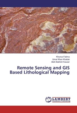
Remote Sensing and GIS Based Lithological Mapping
Autor: Khunsa Fatima
Remote sensing and GIS techniques assist geologists by providing valuable information about geology and minerals of an area to be surveyed, so that geologists spend quality and focused time in the field. The lithology of Khaira Murat Range, Attock Pakistan... Viac o knihe
Na objednávku
33.30 €
bežná cena: 37.00 €
O knihe
Remote sensing and GIS techniques assist geologists by providing valuable information about geology and minerals of an area to be surveyed, so that geologists spend quality and focused time in the field. The lithology of Khaira Murat Range, Attock Pakistan is studied using Landsat ETM+ and ASTER Satellite images. The shortwave infrared and thermal infrared bands of Landsat and ASTER successfully mapped industrial minerals like calcite, quartz, muscovite and montmorillonite.
- Vydavateľstvo: LAP LAMBERT Academic Publishing
- Rok vydania: 2017
- Formát: Paperback
- Rozmer: 220 x 150 mm
- Jazyk: Anglický jazyk
- ISBN: 9783330045781


 Nemecký jazyk

