-
 Anglický jazyk
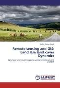
Remote sensing and GIS: Land Use land cover Dynamics
Autor: Sudhir Kumar Singh
This monograph is a study on "Land use and land cover mapping using remote sensing and Geographical Information System (A case study of Rupnagar district, Punjab)". Remote Sensing and GIS is present day need for monitoring, measurement and modeling through... Viac o knihe
Na objednávku
45.36 €
bežná cena: 50.40 €
O knihe
This monograph is a study on "Land use and land cover mapping using remote sensing and Geographical Information System (A case study of Rupnagar district, Punjab)". Remote Sensing and GIS is present day need for monitoring, measurement and modeling through which we can acheive at better decision making. Moreover this monographs deals with the application of Satellite Remote Sensing in land use assessment and will also help in identifying the problem areas and their probable solutions. The main content of the study discuss how the population change is responsible for the change current in land use and future prediction. This monograph will help in creating new knowledge among the students and various other stakeholders. With the help of modern technologies we can make our world more sustainable.
- Vydavateľstvo: LAP LAMBERT Academic Publishing
- Rok vydania: 2011
- Formát: Paperback
- Rozmer: 220 x 150 mm
- Jazyk: Anglický jazyk
- ISBN: 9783846533475


 Nemecký jazyk


