-
 Anglický jazyk
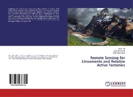
Remote Sensing for Lineaments and Relative Active Tectonics
Autor: Umair Ali
Geologists are continuously facing accessibility problems in carrying field work before reconnaissance related to the area. It is of urgent need to develop remote sensing applications for mitigating the problems faced in field. Scientists throughout the... Viac o knihe
Na objednávku
32.56 €
bežná cena: 37.00 €
O knihe
Geologists are continuously facing accessibility problems in carrying field work before reconnaissance related to the area. It is of urgent need to develop remote sensing applications for mitigating the problems faced in field. Scientists throughout the world are busy in developing the most efficient and innovative methods for development and making research easy in Geosciences. The book describes the application of Remote sensing approach in lineament identification and assessing relative active tectonics. Remote sensing and GIS are easy and cost effective methods for taking any geological research in any terrain.
- Vydavateľstvo: LAP LAMBERT Academic Publishing
- Rok vydania: 2016
- Formát: Paperback
- Rozmer: 220 x 150 mm
- Jazyk: Anglický jazyk
- ISBN: 9783659936715



 Nemecký jazyk