-
 Anglický jazyk
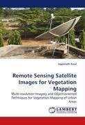
Remote Sensing Satellite Images for Vegetation Mapping
Autor: Jagannath Aryal
During the last 50 years the remote sensing arena has been dramatically improved. At present, it is possible to have remote sensing imagery of less than a metre, which helps to improve our understanding of the interaction of various phenomena. This book... Viac o knihe
Na objednávku
63.00 €
bežná cena: 70.00 €
O knihe
During the last 50 years the remote sensing arena has been dramatically improved. At present, it is possible to have remote sensing imagery of less than a metre, which helps to improve our understanding of the interaction of various phenomena. This book assists to understand the use of very high resolution imagery to extract the ecological entities in urban areas. The importance of such ecological entities - vegetation communities - to human being is characterized using the IKONOS multi- spectral and panchromatic imagery. A case study of a city in New Zealand prevailed that remote sensing images are useful data sources to extract the vegetation communities in an urban area.
- Vydavateľstvo: LAP LAMBERT Academic Publishing
- Rok vydania: 2010
- Formát: Paperback
- Rozmer: 220 x 150 mm
- Jazyk: Anglický jazyk
- ISBN: 9783838325453



 Nemecký jazyk

