-
 Anglický jazyk
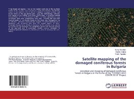
Satellite mapping of the damaged coniferous forests in Bulgaria
Autor: Toma Tonchev
Three forest sub-regions - two at the western and one at the southern border of the country were selected as a study area because they include almost all the coniferous forest stands in Bulgaria damaged by biotic and abiotic factors in the last several years.... Viac o knihe
Na objednávku
24.93 €
bežná cena: 27.70 €
O knihe
Three forest sub-regions - two at the western and one at the southern border of the country were selected as a study area because they include almost all the coniferous forest stands in Bulgaria damaged by biotic and abiotic factors in the last several years. Using the methodology, software and images of the CORINE Land Cover 2018 Project, a computer-assisted interpretation of the multitemporal satellite and aerial digital images was performed. False color compositions were used, including NIR and SWIR spectral bands. All coniferous forests in the study area damaged in the period 2012 - 2018 were detected and mapped. The obtained results were compared with terrestrial data from the annual reports of Forest Protection Station Sofia, which are by years, by the affected areas and by the factors for the damages. The comparison proved the appropriateness of the approach and its advantages became obvious, compared to traditional ground observations, including in terms of accuracy, time and money.
- Vydavateľstvo: LAP LAMBERT Academic Publishing
- Rok vydania: 2019
- Formát: Paperback
- Rozmer: 220 x 150 mm
- Jazyk: Anglický jazyk
- ISBN: 9786200464576




 Nemecký jazyk

