-
 Anglický jazyk
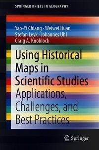
Using Historical Maps in Scientific Studies
Autor: Yao-Yi Chiang
This first SpringerBrief provides a brief review on cartographic practices and their changes. Then this brief presents example case studies of using historical maps in scientific studies and their real-world applications. Next, it describes the... Viac o knihe
Na objednávku
49.49 €
bežná cena: 54.99 €
O knihe
This first SpringerBrief provides a brief review on cartographic practices and their changes. Then this brief presents example case studies of using historical maps in scientific studies and their real-world applications. Next, it describes the challenges and best practices in extracting and modeling map contents. Such a state-of-the-art introduction manual can help researchers interested in using the embedded human knowledge in historical maps to better understand the possibilities of current tools and to employ an efficient workflow for generating reusable datasets. This brief also discusses the current trend and outlook in making large numbers of historical maps searchable by location, time, and content and make their content machine-understandable and available to everyone everywhere.
Detailed knowledge of the past is a critical component for the success in studies in a variety of fields, including humanities, social sciences, and life sciences. Historical maps are a valuable source of geographical and political information (e.g., historical place names, landmarks, natural features, and transportation networks) from the distant past all the way to the near present. Also, they are often the only source that provides professionally surveyed historical data. Today, map archives such as the David Rumsey Map Collection, USGS National Geologic Map Database, USGS Topographic Maps, OldMapsOnline.org, and the National Library of Scotland, store thousands of historical maps in either paper or scanned format. With this exponential growth of available map scans in the archives and on the internet, a variety of disciplines grows interests in using historical maps in their studies. However, researchers can spend a great deal of time and effort converting the content of relevant maps to a usable format (from images) and modeling the map content so that the raw data in maps can be distilled into knowledge that can be used to answer research questions. This process is heavily labor intensive, and the result is that researchers do not get as far as they could have in their work because of the lack of knowledge about automatic map processing and data modeling tools and practices.
The primary audience for this brief includes scientists and researchers whose research requires long-term historical geographic data, as well as librarians. Also, anyone who loves maps will enjoy this SpringerBrief.
- Vydavateľstvo: Springer International Publishing
- Rok vydania: 2019
- Formát: Paperback
- Rozmer: 235 x 155 mm
- Jazyk: Anglický jazyk
- ISBN: 9783319669076


 Nemecký jazyk