-
 Anglický jazyk
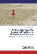
An Investigation into Geospatial Tools for a Multipurpose Cadastre
Autor: Kazi Humayun Kabir
This book addresses the Geospatial Technologies for a Multipurpose Digital Cadastre Prototype of Bangladesh. This is an attempt for the first time in Bangladesh to investigate all the possible applications of Geospatial Tools and Techniques to manage all... Viac o knihe
Na objednávku, dodanie 2-4 týždne
45.36 €
bežná cena: 50.40 €
O knihe
This book addresses the Geospatial Technologies for a Multipurpose Digital Cadastre Prototype of Bangladesh. This is an attempt for the first time in Bangladesh to investigate all the possible applications of Geospatial Tools and Techniques to manage all multipurpose cadastral information. The reliable land related information could be achieved within a computer system combined with a Geographic Information System (GIS) and multipurpose cadastral information which is the basis for land markets and sustainable development (e.g. social, economic, environmental), land assessment and taxation, better information base for planning and administration, improving map production, less litigation and less work for the courts, secures land ownership rights and regular update of land information. The Author has made an initiative to study the new and possible dimensions of advanced geospatial tools for a multipurpose cadastre in this book. It is hoped that the books will be very helpful for the thinkers, learners, teachers, researchers and other groups of people who work with land affairs and Geospatial Technologies.
- Vydavateľstvo: LAP LAMBERT Academic Publishing
- Rok vydania: 2011
- Formát: Paperback
- Rozmer: 220 x 150 mm
- Jazyk: Anglický jazyk
- ISBN: 9783845472904


 Nemecký jazyk


