-
 Anglický jazyk
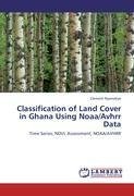
Classification of Land Cover in Ghana Using Noaa/Avhrr Data
Autor: Clement Nyamekye
Since the 1970's, it has been possible to recieve radiometric data from meteorological and earth resource satellites that allow us to analyze the interaction between the solar radiation and ocean, atmosphere and land properties. Landcover information constitutes... Viac o knihe
Na objednávku, dodanie 2-4 týždne
45.36 €
bežná cena: 50.40 €
O knihe
Since the 1970's, it has been possible to recieve radiometric data from meteorological and earth resource satellites that allow us to analyze the interaction between the solar radiation and ocean, atmosphere and land properties. Landcover information constitutes key environmental information for many scientific, resource management and policy purposes, as well as for a range of human activities. It is important that it has become a major focus for international Geo-sphere Program(IGBP)and International Human Dimension Program. The study of this conversions necessitates the use of remote sensing because it provides data at synoptic scales and facilities of large-scale ecosystem patterns. Although remote sensing technology has been used for mapping in ghana for sometime now, there have been no attempts to use the unsupervised or supervised classification methods for NOAA/AVHRR images for the whole of Ghana. Therefore, a quality approach to the use of historical series of low resolution NDVI data to produce land cover maps of Ghana and also to evaluate the relative change in land cover from 1982-2002.
- Vydavateľstvo: LAP LAMBERT Academic Publishing
- Rok vydania: 2012
- Formát: Paperback
- Rozmer: 220 x 150 mm
- Jazyk: Anglický jazyk
- ISBN: 9783847335573


 Nemecký jazyk

