-
 Anglický jazyk
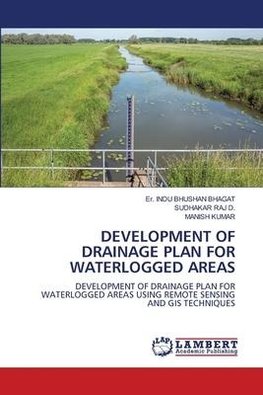
DEVELOPMENT OF DRAINAGE PLAN FOR WATERLOGGED AREAS
Autor: Er. INDU BHUSHAN Bhagat
The combined use of remotely-sensed images and GIS based environmental applications in this work is needed for systematic ideas and scientific planning in the Darbhanga district of Bihar. The index-based classification method was followed in an ArcGIS software... Viac o knihe
Na objednávku, dodanie 2-4 týždne
56.43 €
bežná cena: 62.70 €
O knihe
The combined use of remotely-sensed images and GIS based environmental applications in this work is needed for systematic ideas and scientific planning in the Darbhanga district of Bihar. The index-based classification method was followed in an ArcGIS software and as a result, various indices such as NDVI, NDWI, MNDWI (Esri), MNDWI (IHS) had been obtained to assess the water-logged portions. The total area subjected to water-logging in the Darbhanga district was found to be 42,282 ha. The area of water-logging was found in the two sub-divisions of the Darbhanga district. The blocks of Darbhanga and Biraul sub-division, holding the water-logging area of 21,899 ha and 20,383 ha respectively. The surface drainage plan for the blocks of Darbhanga and Biraul sub-divisions have been expressed by showing the main drain lines and outlets which was based on the comparison of different thematic maps. The useful measures also have been suggested to execute the drainage plan in an active manner.
- Vydavateľstvo: LAP LAMBERT Academic Publishing
- Rok vydania: 2023
- Formát: Paperback
- Rozmer: 220 x 150 mm
- Jazyk: Anglický jazyk
- ISBN: 9786206145509

 Nemecký jazyk


