-
 Anglický jazyk
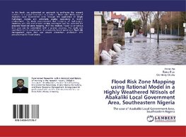
Flood Risk Zone Mapping using Rational Model in a Highly Weathered Nitisols of Abakaliki Local Government Area, Southeastern Nigeria
Autor: Daniel Aja
In this book, we elaborated an approach to synthesize the relevant database in a spatial framework to produce a flood vulnerability map of Abakaliki Local Government Area through the application of simple hydrologic models and arithmetic overlay operations... Viac o knihe
Na objednávku, dodanie 2-4 týždne
36.99 €
bežná cena: 41.10 €
O knihe
In this book, we elaborated an approach to synthesize the relevant database in a spatial framework to produce a flood vulnerability map of Abakaliki Local Government Area through the application of simple hydrologic models and arithmetic overlay operations in ArcGIS environment. The study demonstrated that Coupling of hydrological modeling with GIS and remote sensing techniques has the potential for accurate flood risk zone mapping. With this method, flood risk of various land uses can be determined with a greater accuracy. This study can contribute to the development of community based sustainable flood risk management plans that can ensure prevention, protection and preparedness for flood events.
- Vydavateľstvo: LAP LAMBERT Academic Publishing
- Rok vydania: 2019
- Formát: Paperback
- Rozmer: 220 x 150 mm
- Jazyk: Anglický jazyk
- ISBN: 9783659573767


