-
 Anglický jazyk
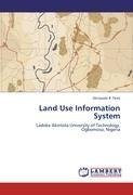
Land Use Information System
Autor: Akinyode B. Femi
Landuse Information System (LIS) also known as Landuse Related Information System (LRIS) is a special type of Geographical Information System (GIS) which is designed to handled detailed landuse information. This study aims at creating a digital Information... Viac o knihe
Na objednávku, dodanie 2-4 týždne
45.36 €
bežná cena: 50.40 €
O knihe
Landuse Information System (LIS) also known as Landuse Related Information System (LRIS) is a special type of Geographical Information System (GIS) which is designed to handled detailed landuse information. This study aims at creating a digital Information System for landuse planning, landuses changes and management within Ladoke Akintola University of Technology (LAUTECH), Ogbomoso Campus. The study goes through database design, database creation, geometric and Attributes data acquisition on different landuses. The thematic maps used were scanned, digitized and converted into digital format. Various classifications and geospatial data analysis or manipulation were made to retrieve spatial information easily at anytime. The queries and analysis performed can be used for effective record keeping, proper maintenance, good planning and allocation of land for various uses to enhance an environment that is conducive for learning and working for both the students and staff. The achievement of the aim and objectives of this project unfold the eyes of the management, staff and students to importance of GIS in landuse planning and management in LAUTECH, Ogbomoso, Nigeria.
- Vydavateľstvo: LAP LAMBERT Academic Publishing
- Rok vydania: 2012
- Formát: Paperback
- Rozmer: 220 x 150 mm
- Jazyk: Anglický jazyk
- ISBN: 9783847322030

 Nemecký jazyk
