-
 Anglický jazyk
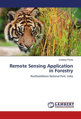
Remote Sensing Application in Forestry
Autor: Kuldeep Pareta
The main purpose of this book is to present the detail remote sensing application in forestry with a special case study of Ranthambhore National Park, India. A short glance is presented on the fundamental of remote sensing, earth observation satellites and... Viac o knihe
Na objednávku, dodanie 2-4 týždne
91.53 €
bežná cena: 101.70 €
O knihe
The main purpose of this book is to present the detail remote sensing application in forestry with a special case study of Ranthambhore National Park, India. A short glance is presented on the fundamental of remote sensing, earth observation satellites and sensors, introduction to image interpretation & instruments, remote sensing application in natural resource management, agricultural, crop inventory, ecology, soil, hydrology, hydro-geomorphology, water resource management, petroleum, and disaster risk management. The comprehensive remote sensing application in forestry with spectral properties of vegetation, baseline data collection, forest cover mapping, land use land cover mapping, change detection techniques, afforestation & deforestation, habitat mapping & modelling, forest fire risk zonation, forest carbon management of Ranthambhore National Park are presented in the book. The concept on Microwave and LiDAR remote sensing for forestry are also described in brief. The book is useful for the instructors, research scholars and students of forestry, remote sensing, geographic information system, geography, and botany for the detail study in the field of forestry remote sensing.
- Vydavateľstvo: LAP LAMBERT Academic Publishing
- Rok vydania: 2014
- Formát: Paperback
- Rozmer: 220 x 150 mm
- Jazyk: Anglický jazyk
- ISBN: 9783659554759
 Nemecký jazyk