-
 Anglický jazyk
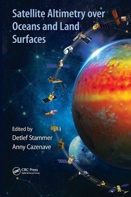
Satellite Altimetry Over Oceans and Land Surfaces
Autor: Anny Cazenave
Satellite remote sensing, in particular by radar altimetry, is a crucial technique for observations of the ocean surface and of many aspects of land surfaces, and of paramount importance for climate and environmental studies. This book provides a state-of-the-art... Viac o knihe
Na objednávku, dodanie 2-4 týždne
290.25 €
bežná cena: 322.50 €
O knihe
Satellite remote sensing, in particular by radar altimetry, is a crucial technique for observations of the ocean surface and of many aspects of land surfaces, and of paramount importance for climate and environmental studies. This book provides a state-of-the-art overview of the satellite altimetry techniques and related missions, and reviews the most-up-to date applications to ocean dynamics and sea level. It also discusses related space-based observations of the ocean surface and of the marine geoid, as well as applications of satellite altimetry to the cryosphere and land surface waters; operational oceanography and its applications to navigation, fishing and defense.
- Vydavateľstvo: CRC Press
- Rok vydania: 2017
- Formát: Hardback
- Rozmer: 260 x 183 mm
- Jazyk: Anglický jazyk
- ISBN: 9781498743457


 Nemecký jazyk


